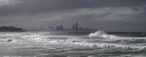
East Coast Weather ‘Traffic Jam’
Repeated storms of autumn along the east coast are not something new. I was struck by an account in The Australian 27/3/22. Reference was made to a meteorological “traffic jam” as the cause of our flooding woes. This statement was in the context of the second extreme event; now we are experiencing a third!
Jackson Browne of the Bureau of Meteorology (BoM) referred to the rain event as the result of a “blocking high” in the Tasman Sea. This prevented the normal west-east translation of weather systems. In his words “When the weather patterns can’t move as usual they tend to crowd up just like a traffic jam. Because of that, it’s causing an otherwise innocuous trough in Queensland to deepen and that deepening will lead to a low-pressure system which will become a major focus to the rainfall”.
I was quite excited to read this explanation. It brought back memories of my work on secular variation in coastal wave climates. In 1974 I was trying to understand stop-start processes of sand deposition by waves and winds along the east coast. This covered several time scales from contemporary coastal erosion events to those recorded in the past 100 plus years, and onto the last 6000years. Trying to bring this together through a study of interconnected atmosphere-ocean-sediment transport dynamics was quite a challenge so I sought help. Lots of ideas were floating around at the time and papers were appearing in the atmospheric science literature on sea-air coupling, the importance of sea surface temperature (SST) anomalies, and storminess. I contacted BoM and made arrangements to meet staff for advice.
David Wright, the then long-range forecaster in Melbourne, made time to see me and he was an inspiration. He opened my eyes to reports and literature relevant to changes in atmospheric behaviour. As a forecaster he had become more and more interested in the role of SST influencing weather. One report that enlightened me was by S. Karelsky (“Surface circulation in the Australian region”, Aus. Bur. Met., Met. Studies, 3, 1954). He had painstakingly examined weather charts going back 50 years or so looking for patterns of flow in pressure systems across the continent. One year stood out, 1950. I knew from a previous study of coastal erosion events that 1950 had several major storms (published in Search, 1974, 5, 198-209). In that year a blocking high over the south Tasman was linked to low pressure (or “east coast low”) formation. Karelsky showed how it stood out from the “normal” west-east zonal patterns in cooler months of the year. David pointed me to more recent papers by Simpson and Downey and by Trenberth that highlighted the influence of SST on cyclogenesis as a possible cause of this blocking pattern.
I summarized these findings in 1978 in a paper written in honour of a great mentor, Joe Jennings. It was published as Chapter 9 in “Landform Evolution in Australia” (eds. J. Davies and M. Williams, ANU Press, p.197-214). In figure 9.3 a somewhat schematic attempt was made to bring together these ideas. It indicated an interacting ocean-atmosphere system responsible for significant episodes of increased storms involving enhanced blocking high action and a split jet stream. The storms generated erosion events along the east coast. This winter cyclogenesis pattern in the Tasman Sea reflected more “meridional” flow as against the “normal” zonal circulation. It was seen as an outgrowth of air-sea coupling induced by a prevailing SST pattern. I concluded “The Change in location, frequency and magnitude of extra-tropical cyclones thus reflects the forcing influence of abnormal pre-existing SST patterns or gradients which promotes their excitation” (p. 209).
All this seemed reasonable back in 1978. It still makes some sense to me. However, I was not then aware of the how all this could relate to La Nina events. Over the years my direct interest in ocean-atmosphere dynamics has waned and others such as Ian Goodwin have developed a more informed understanding of these complex linkages leading to coastal change. Multiple extreme storm events may occur during a La Nina period. Karelsky identified such a year (1950), but so was 1967 and 1974 (perhaps also 1912 as documented by E.C. Andrews—see Thom, 1974). The question is what can we expect for the rest of autumn and winter in 2022? The beaches have been primed for further erosive and inundation impact. La Nina is said to remain till June and SST remain high—it is wait and see and be prepared.
The extent to which climate change is exacerbating these “traffic jam” effects is not clear. A warmer atmosphere induces more moisture availability. That may explain the high rainfall totals. Nevertheless the historic record tells us that such effects do occur and the expectation will be with each La Nina similar cyclonic events can occur and perhaps more frequently than in the past. It is time to think less of events such as 1-in-500 year, but to frame probability of occurrence around El Nino-La Nina periods. Geoff Summerhayes, formerly with APRA, summed it up as “We are doing a disservice, I think, to the Australian public by using a narrative that is contextualising these events as that they’re not going to happen again for another 500years…The science is telling us these events [includes bushfires] are going to be more frequent, more extreme, and they are indeed not in the category of one in 500 years” (SMH, 15/3/22). Surely we now have more confidence in the science to plan ahead once the signal for the arrival of an La Nina is made public.
Bruce Thom
Words by Prof Bruce Thom. Please respect the author’s thoughts and reference appropriately: (c) ACS, 2022. For correspondence about this blog post please email austcoastsoc@gmail.com
#213
By Prof Bruce Thom | Monday, April 11, 2022 |


