


Nature’s coastal beauties: A selection
A listener to ABC Radio NSW South Coast recently called and asked if someone could explain beach cusps. He had observed them at Wallaga Beach and knew they also occurred at Hyams Beach in Jervis Bay, and Pearl Beach just inside Broken Bay. I was invited to offer my thoughts on these wonderful features mentioning ideas that are in Blog 140 (June 2019) entitled “Curiosity of Cusps”. It struck me that there are many coastal features like cusps that have regular patterns that excite not just coastal scientists, but also those who seek information about such small-scale topographic/geologic forms.
I do not plan to discuss hypotheses on the origin of various features mentioned below. Rather I wish to offer some of those features which over the years have excited me adding a few notes as to why.
First there are those micro-topographic structures that can be observed on rocky coasts. Rambling across rock platforms is a joy to experience with a double lens: that of a geomorphologist and that of an ecologist. The two come together as zones by which different species seek niches that reflect minor changes in water level and wave inundation. Fissures follow joint planes which depending on rock type may show strong geometrical patterns such as cubic structures in massive sandstones and as hexagonal blocks in basalt (e.g. Giant’s Causeway in Northern Ireland). In sandstones, semi-circular potholes may have case-hardened rims rich in iron oxide that stand above the general platform surface by a few centimeters.
In the Sydney region the sandstone cliffs offer impressive examples of two striking features: tafoni and Liesegang rings. Both occur in non-coastal areas. However, there are several places where I try to explain their origins to those who come on my excursions. Tafoni (or honeycomb weathering) are rounded cavities generally associated with coarse-grained sandstone or crystalline rocks. They may also have case-hardened rims but with softer cores often containing loose sand. Periodic wetting and drying involving salty waters appears to be a factor in their formation, but the mystery is the overall arrangement of interlaced hollows on a rock face. These rock surfaces may also display Liesegang rings. Hard to explain, they consist of cemented bands of different colours that can cut across sandstone bedding planes in regularly repeating patterns. Clearly the rings formed after the sandstone was deposited presumably associated with circulating groundwaters containing iron in solution many millions of years ago. Their beauty is to be seen up close to be fully appreciated.
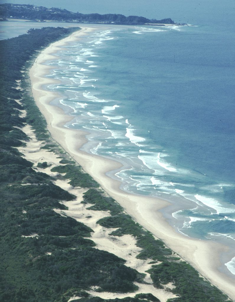
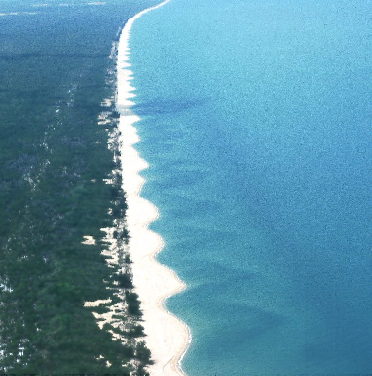
Andy Short kindly provided me with a set of photos to highlight rhythmic formations on sandy beaches. These are presented here as an image gallery (above). Research on their formation and dynamics can be found in various chapters in the book Andy edited “Handbook of Beach and Shoreface Morphodynamics” (1999, John Wiley & Sons Ltd, England).
Two photos show what are referred to as “megacusps” with sand bars linked to rip currents, one from near Jantz Point just north of Weipa in the Gulf of Carpentaria, the other from Forster Beach north of Nambucca Heads. Andy noted that the Weipa features remain inactive between cyclones. Another cusp image is from Whirinaki Beach on the North Island of New Zealand. This remarkable array has been formed in gravel on what is termed a “reflective beach” dominated by swash runup over a steep beachface (see Short, 1999, Chapter 7, p.193-5).
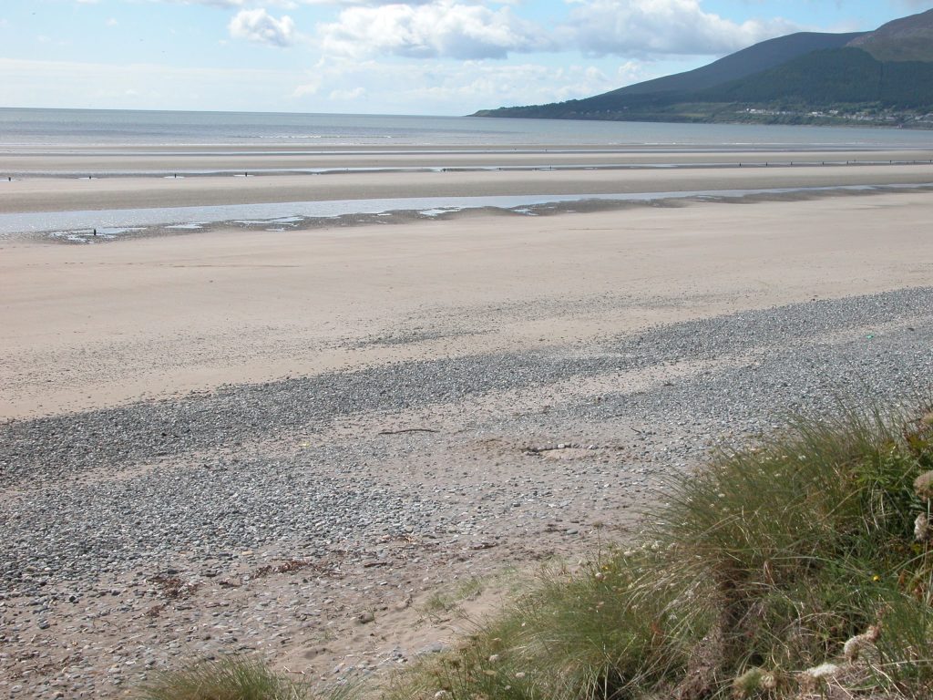
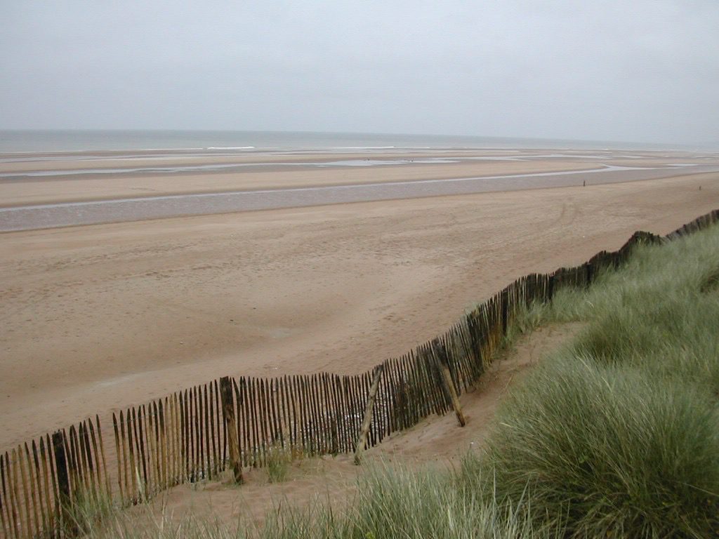
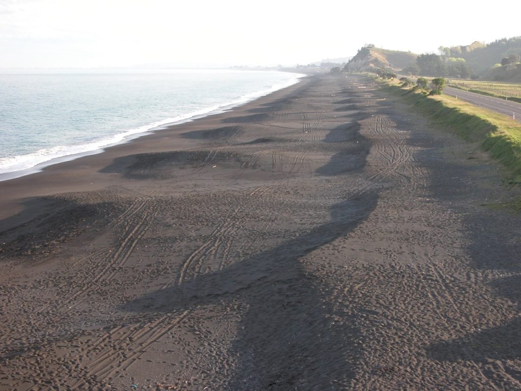
Where tides are beyond 2m, a sandy beach may form a series of shore-parallel ridges (see Masselink and Turner, Chapter 8 in Short, ed., 1999, for details on the morphodynamics of this complex beach system). They are sometimes called “ridge and runnel” beaches. The spacing between ridges can increase offshore. They occur in areas that receive occasional storm waves on an open coast. Two examples are shown here. One is from Dundrum in Northern Ireland, the other from Omaha Beach in Normandy, France. The latter is famous as the location for D-Day landings in World War II. It was the subject of pre-landing reconnaissance. However, information provided was insufficient as some landing craft got stranded on the ridges and many soldiers drowned trying to wade ashore or were otherwise unable to reach the shore. Lack of knowledge on beach and nearshore conditions in such areas, and on coral/beachrock coasts in the Pacific, stimulated considerable postwar research by the US Office of Naval Research. It constituted a national program of which both Andy and I benefitted as graduate students at Louisiana State University.
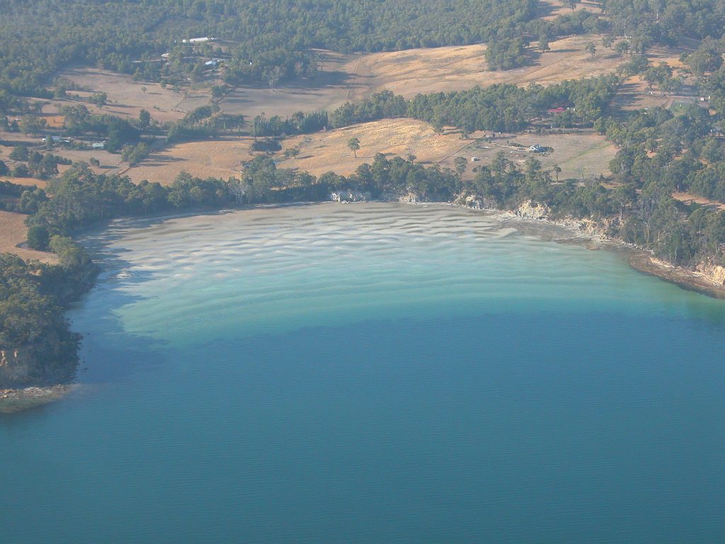
The final photo is somewhat typical of shallow sandy shore flats from low energy sites usually within enclosed bays or estuaries which receive energy from wind-driven waves only. The example provided by Andy is from Parker Beach southern Tasmania where the tidal range is microtidal. There are on average 7 ridges in similar bay settings more or less equally spaced. Google Earth imagery of Rose Bay within Sydney Harbour shows a splayed pattern of ridges diverging in two directions from a central point at the eastern end of the bay. It appears that wind waves from two directions are active here.
This blog is a snapshot of wonders of nature that has excited me. These rhythmic and regular formations found in coastal areas should continue to stimulate the curious and future researchers. I am always interested in what excites others as they wander along our coastal shores.
Bruce Thom (with many thanks to Andy Short)
Words by Prof Bruce Thom. Please respect the author’s thoughts and reference appropriately: (c) ACS, 2025. For correspondence about this blog post please email admin@australiancoastalsociety.org.au
#281