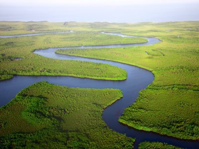
The history of the NSW coastal boundary goes back to the Coastal Protection Act 1979. In several ways this Act mirrored 1976 Californian coastal legislation. For purposes of coastal management and planning the coast was a line on a map that made planning processes relatively straightforward.
Over the years different reviews have highlighted how other states and the Commonwealth approached the definition of a Coastal Zone. In 2009, the “George Report” of the House of Representatives Standing Committee summarised the different state approaches to coastal management (see Appendix F). NSW is the only state to have since 1979 a specified mapped line that excluded catchments. I recall that Tasmania had a legal case that required the Government in 1996 to draw a “line” and not use a broader definition.
In 2004 at a coastal conference in Tasmania an oyster farmer expressed concern how farmers upstream in the catchment could capture freshwater in dams with adverse results on water quality in estuaries. At the time I was curious that there were no apparent limits on such extractions and that aquacultural industry had no legal recourse to harmful impacts. In more recent years other cases of overuse of water for irrigation has been the source of much debate. The classic case is in the Murray Darling Basin leading to the Water Act 2007 and the MDB Plan 2012. The Act formally recognises “overuse” and “over allocation”. Impacts on the estuary area of the Lower Lakes and Coorong during the Millennial Drought became very evident in our study of the interplay of coastal and fluvial processes (see Thom et al., River Research and Applications, 2020, v. 36, 656-667). Other coastal lakes and estuaries are suffering from upstream “capture” of freshwater often accompanied by the denial by those involved that water heading to the sea is “wasted”. I have been alerted to the potential impacts of such effects on Gippsland Lakes as irrigation developments take place in catchments. This is a real worry as just as in the Lower Murray area, the integrity of Ramsar wetlands is at risk. The NSW Government is currently calling for comment on a new policy that would increase harvestable rights of farmers in coastal catchments. See further information here.
Another component of catchment behaviour affecting estuaries and marine waters involves the discharge of pollutants. I am reminded of a useful paper by Arthur Conacher in Australian Geographical Studies (2002, v. 40, 179-195) on a role of geomorphology in integrated catchment management. He makes the obvious point that catchments are integrated through water movements:
“Water moves sediments: and the translocation of materials has geomorphic and pedological responses. Fertiliser and pesticide residues and other toxic substances are also transported by water, in solution and attached to sediment particles., affecting various ecological components of catchments. The insertion of pollutants is directly caused by land-use practices” (p, 179).
While he goes on to highlight how geomorphologic elements and human activities are interrelated, he makes it clear that “complex skills are involved in producing and implementing a management strategy, including but extending well beyond those of a geomorphologist”. Nowhere is this point clearer than for drainage into coastal waters of the Great Barrier Reef and highly urbanised catchments feeding maritime waters at Brisbane, Sydney, and Melbourne. And in all such cases the skills extend “beyond” those of natural science extending into areas of human behaviour, public policy, and politics.
Much has been written about plans to reduce nutrient and sediment discharge from farmlands of GBR catchments. Both Queensland and Commonwealth governments have invested resources into mitigating adverse impacts on reef ecosystems. Wolanski has edited a very powerful set of papers on different estuaries indicating how some like Sydney and the Tamar have legacy issues of contaminants to manage (Wolanski, E., 2013, Estuaries of Australia in 2050 and Beyond, Springer).
Catchments are also the source of floods that inundate low-lying coastal lands. Knowledge of how such flooding intersects with extreme storm events that generate storm surges becomes an important part of coastal management. For instance it can affect insurance premiums and claims. Too often that link is ignored by those who focus only coastal systems.
Coastal management cannot ignore what is happening beyond the lined boundary of a Coastal Zone. For purposes of planning decisions there are advantages in having a defined zone which is associated with particular coastal environmental, social, and economic conditions. But that zone is under the influence of what is happening in river catchments. Increasingly we are seeing the need to highlight those links that impact on the management decisions and living in coastal cities and settlements. There may be no firm boundary shift required in defining the Coastal Zone but we cannot ignore the influence of catchment dynamics in CZM.
Bruce Thom
Words by Prof Bruce Thom. Please respect the author’s thoughts and reference appropriately: (c) ACS, 2021. For correspondence about this blog post please email austcoastsoc@gmail.com
#184


 Coastal Archaeology Revisited