Victorian Coastal Monitoring Program

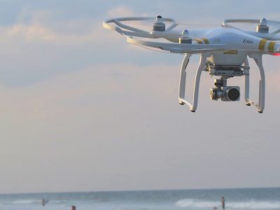
I recently attended a meeting of the Advisory Board of the new Victorian Coastal Monitoring Program (VCMP).This program was established last year as a partnership between the Department of Environment, Land, Water and Planning (DELWP) and Deakin and Melbourne universities: “to develop predictive models of future shoreline behaviour through understanding sediment dynamics derived from the latest innovative technologies from multibeam and subbottom sonar mapping, citizen-science UAV/drones and disciplines including remote sensing, marine sedimentology and habitat mapping”. It involves a $3m investment from the State Government. The leaders of the program are Dan Ierodiaconou from Deakin and Dave Kennedy from Melbourne. They are supported by a team of postdoctoral fellows, PhD students and research assistants.
The Advisory Board was presented with a summary of VCMP open coast projects. It was an excellent opportunity for folk like Colin Woodroffe, Scott Nichol and Mike Kinsela and myself, from out of state, and others present, to learn about the diverse range of interests within the VCMP. Officials from DELWP were keen to get feedback at this early stage so there was ample opportunity for discussion. New post-doctoral fellows such as Rafael Carvalho were able to bring their experience from NSW into the program along with an enthusiastic bunch of PhD students. Victoria does not have an in-house research group in DELWP like that in OEH. To be able to assemble a university team that is equipped to undertake such a baseline program is an alternative approach to coastal monitoring under the new Coast and Marine Transition Plan.
In August, 2018, the Victorian Government released its Marine and Coastal Reforms: Final Transition Plan. This followed the passage of the Marine and Coastal Act 2018. It is a statement outlining policy and actions to address long-term challenges facing the marine and coastal environment under threat from climate change and population growth. It also recognises issues of ageing infrastructure and community assets, and in this context it seeks to address the findings of the Victorian Auditor-General’s Office (VAGO) report entitled “Protecting Victoria’s Coastal Assets”. The Plan details a number of actions against 6 transition plan functions:
- Knowledge of the condition of marine and coastal environments over time;
- Statewide policy and strategic advice;
- Deliver strong integrated regional issues based planning;
- Clear planning and controls about access use and development;
- Well resourced, efficient and effective management;
- Community and user groups aware and involved in decision making.
DELWP is the lead agency for all actions with a range of external partners, such as Melbourne Water, CMAs, NGOs, Local Government, Parks Victoria and universities. Many of the actions note the link to VAGO recommendations.
The monitoring program (VCMP) is listed under Action 1.4 of the Plan with universities as the external partner to DELWP. It refers to the need to establish a database for coastal hazard information that will link to the Victorian Flood Database, and is due to be completed by mid-2021. The Plan outlines action scope and success measures, including completion of a statewide coastal hazard assessment (2nd Pass scale) which will be made publicly accessible.
The Advisory Board of the VCMP was asked to comment on a range of issues related to the overall program and its specific elements. It was clear that time and resources available limit the degree to which a comprehensive statewide assessment could be undertaken. At this stage considerable effort was being concentrated on sediment compartments in the western region. Here there was an opportunity to focus on both offshore and onshore sediment characteristics, benthic conditions and shoreline changes, and providing a geologic-geomorph background to understand coastal dynamics. It also included locations where coastal erosion was a problem for local communities (e.g. Apollo Bay). However, investigations are occurring elsewhere such in Port Phillip Bay and near Inverloch and Seaspray, as well as more broad-scale work such as that by Teresa Konlechner on historical coastal erosion over decadal time scales (also funded by the Earth System and Climate Change Hub of the Australian Government).
We were presented with the output of a number of studies involving an array of different field and laboratory techniques. This was most impressive. For instance, the program has access to 90 days boat time to do sediment sampling, shallow-water seismic, and multi-beam scanning. There are plans to go into detail with facies mapping of sediment types with assistance of Geoscience Australia. Discussion at the meeting on modelling approaches, application of new tools in remote sensing and the use of UAVs in shoreline monitoring were most illuminating.
There are several issues facing the rollout of Action 1.4 of the Plan. It is short-term and dependent on university engagement through employment of non-tenured staff and postgraduate students. Much of the work will have a research focus and not necessarily address particular needs of communities. However, this point is countered to some degree by the inclusion of a citizen science component in the program. Another restriction on the program are limits by Parks Victoria on areas where drones are permitted to fly; we were informed that this is a matter for further consideration. One can only hope the DELWP will be able to sustain Action 1.4 beyond 2021 as it will offer the State an enormous source of information to address those key issues they know will require long-term investment.
Bruce Thom
Words by Prof Bruce Thom. Please respect the author’s thoughts and reference appropriately: (c) ACS, 2019, for correspondence about this blog post please email austcoastsoc@gmail.com
#132


