ANZGG CONFERENCE AT INVERLOCH, VICTORIA

I recently attended the 18th Biennial Australian New Zealand Geomorphology Group conference in delightful Inverloch in the south Gippsland region of Victoria. This conference is held at a place in either Australia or New Zealand where there are exciting geomorphic features. Inverloch was no exception. It was a privilege to be invited this time to give the key note on “Public Policy and the Law: the influence of geomorphology”. I dedicated this talk to the late John Chappell. His wife, Helen, was at the conference dinner and spoke about John with great feeling; I was asked to give the response on behalf of the Group, another tremendous privilege to honour this great man.
I must confess to feeling guilty over my lack of attendance at meetings of ANZGG. As one whose bread and butter for many years was underpinned by a love of geomorphology, I have only been to four meetings. While one can find excuses, I came away from this meeting realising how much I have missed. Coastal research has not been strong at most conferences. Many coastal folk find other venues to communicate their interests. Sadly we have not seen the value of listening to those engaged in other fields of the discipline. But Inverloch was different.
Ian Rutherfurd of Melbourne University and his team had put together a wide ranging program. Ian did a fantastic job. There was a good gathering of coastal geomorphologists and their postgraduate students. John Webb from La Trobe provided a geologic and landform background and this was enlightening for those like me who had never been to this section of the Victorian coast. It was great to meet David Kennedy and his students who have been actively working in this area. ANZGG do a great job in encouraging students to present their work. I found it most pleasing to meet these folk so active and enthusiastic in basic research.
The result was a good cross-section of papers covering various geomorphology topics in Australia and New Zealand with the odd presentation looking at examples from elsewhere. It became apparent that younger generation of geomorphologists have at their disposal techniques of observation, experimentation and modelling that were not around 10-20 years ago; or at least were not at a stage where their application was useful. One exciting area involved the use of drones. Several papers demonstrated the way aerial images from drones enhance monitoring and interpretation of landscape change. Many studies embraced OSL dating; my past obsession with radiocarbon is really old hat.
Special mention should be of the fluvial geomorphology session in honour of the late Wayne Erskine, organised by Mike Saynor. We all owe a great debt of gratitude to Wayne with his many contributions to Australian geomorphology (and also to fishing!). The six papers in his honour did justice to his great work. I recall thinking about his historical fluvial research while being questioned at the South Australian Royal Commission on the Murray-Darling last year. His work on drought versus flood-dominated stream regimes came to mind as I pondered over the inadequacies of river hydrological modelling based on average flows with no consideration of the dynamics of temporal shifts in fluvial conditions.
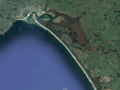
John Webb, James Driscoll, David Kennedy and others ran a day long field trip from Flat Rocks, west of Inverloch, to Waratah Bay/Walkerville to the east skirting the barrier lagoon of Andersons Inlet with its well-developed flood and ebb tide deltas. There were 5 stops each with contrasting points of interest. James provided the background geology, John the Quaternary story and David offered us details on the Holocene history and dynamics including a good look at some well-developed rock platforms at Flat Rocks. Despite the interesting presence of some Palaeozoic rocks (e.g. Cape Liptrap), it is the Cretaceous that provides the geologic backbone (this is a dinosaur coast) with Neogene clastics as an overlay. Some of these silica-rich sands have been reworked during the Last Glacial Maximum by NW winds in contrast to the current role of SW winds forming dunes in calcareous sands behind the beaches. But most exciting to me were examples of neotectonics with faulting of a Holocene rock platform at Flat Rocks and uplifting of the Last Interglacial shore platform at the Waratah Fault near Walkerville. The surface of this platform is remarkably smooth; it is cut into deeply weathered Devonian turbidites. It slopes from around 7m to 3m (perhaps less as the exposure is buried under colluvium). The elevated surface is covered by 4-5m of weathered colluvium. An OSL date of 132,000 was obtained on marine sand with basal quartz pebbles overlying the platform at 5m above present sea level. It is so very different to what I have seen along the east coast. As noted in the field guide, and I agree, this area is arguably one of the most interesting geological and geomorphological sites in Victoria.
Bruce Thom
Words by Prof Bruce Thom. Please respect the author’s thoughts and reference appropriately: (c) ACS, 2019, posted 13 February 2019, for correspondence about this blog post please email austcoastsoc@gmail.com
#129


 Coastal science and the Murray River mouth