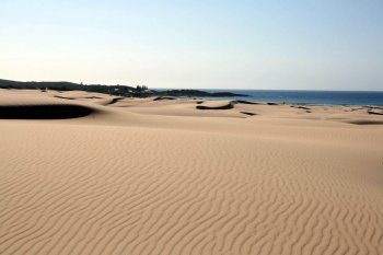
1960 Dune Tour of Port Stephens

Back in 1960 I had the opportunity to undertake an honours project on the dunes and other coastal landforms of Port Stephens and Myall Lakes. It was not my first visit. In fact the reason I selected the area for study was a trip with my mother and her sister during my high school years and was excited by the scenery. As an undergraduate, both Trevor Langford-Smith and Joe Jennings encouraged me to return to Port Stephens for a serious look at that which had previously inspired me.
Over a number of decades it has been possible to work with a range of geologists, geomorphologists and ecologists on the natural history of the area. They are all too numerous to mention here, but I must pay special tribute to those who assisted me in the production of the 1992 monograph published by ANU Press: Peter Roy, Cheng Ly, Mike Shepherd, Greg Bowman and Pat Hesp. Their individual and collective efforts provided me with encouragement to add to those observations I had made through mapping, drilling and dating since those formative honours years.
Since 1992 I have made many trips to Port Stephens, with colleagues, with students and overseas visitors. Last year it was a pleasure to show some of what I had learnt about the area including Myall Lakes, to Mike Kinsela of OEH. Last week I was invited by Colin Woodroffe to join him and Randy McBride, on sabbatical at Wollongong from the USA, to not only show them around, but also to meet staff from the NPWS involved in management of the Stockton mobile dunes. So out came the monograph to remind me of the past work and to drive around features that brought back many warm and in places not so warm memories such as being escorted off a property at the point of a shot gun—I was only trying to measure dune slope angles not steal his chickens!
The area between Newcastle and Port Stephens offers a variety of coastal depositional landforms; a virtual treasure trove for a morphostratigrapher which is what I claimed to be in the 1970s armed with a very useful drill rig and a highly skilled driller ( Karl Shaw). Interestingly, Randy also sees himself as a Quaternary morphostratigrapher. We visited the Last Interglacial Inner Barrier otherwise known as Tomago Sands including the site where the two species of corals were found that John Marshall dated using uranium series technique published in Nature in 1976. These dates confirmed the age of this extensive Pleistocene bay barrier. The surface of the barrier was partially reworked by westerly winds into longitudinal dunes during the Last Glacial as confirmed by TL dates arranged by Ted Bryant. And so onto the Outer Barrier of Newcastle Bight of Holocene age with its complex array of accretionary foredune ridges overlain for much of the 30 km length of the barrier by two phases of stabilised transgressive dunes and the current mobile dune sheet.
I was also able to show Colin and Randy the boulder beaches at Boat Harbour. This is an amazing location with the tough toscanite boulders consisting of a higher level of weathered rocks covered in trees grading to fresher and larger blocks extending below sea level. They were first described by Sussmilch in the 1920s and then again in the 1992 monograph. Sand dunes change their character as you approach Nelson Bay. In what I called the Tomaree area, the dunes are well vegetated and podzolized, and in places wrap themselves around conical rock hills. It was clear that these dunes had been inactive in the Holocene and quite possibly were of several generations in the late Pleistocene; we await an enthusiastic student with OSL dating skills to dissect the record. The landscape can be best viewed from the summit of Gan Gan Hill. Many homes have been built on sands of the dunes around Nelson Bay and Shoal Bay and in areas that were mined for heavy mineral at Salamander Bay. At Fingal Bay we visited the site described by Edgeworth David and others where freshwater peat and stumps were exposed on the foreshore; alas they are now buried under beach sand. This is a beautiful arcuate bay with many intricate features linked to Point Stephens via a tombolo.
We were fortunate to drive along Stockton Beach and the mobile dune field starting at Birubi Point and exiting about 20km to the southwest at Lavis Lane. This is an area that has long fascinated me. The active dune area can be divided into three parts running parallel to the beach: frontal or foredunes, deflation plain and high mobile reversing dunes perched on a sand sheet that is moving inland over vegetated dunes. In the monograph we spent time describing the character and changes over time of parts of the dunefield. On this trip the NPWS staff were anxious to show us impacts of vehicles on the vegetation of the frontal dunes. They have used drone images to document recent destruction of vegetation and associated degradation of foredune features. Nick Pucino from Italy, who is a postgraduate at Wollongong, came with us and showed his LiDAR images and measurements of dune changes. I was saddened to see how much of the deflation plain with its vegetated lakes was covered by sand that had been apparently blown through the many gaps in the partially vegetated frontal dune system.
Between Newcastle and Port Stephens the array of landforms of different scales represents a gold mine for the curious geoscientist to study. I have been privileged to have had a go, now it is up to others; there is still lots more to learn here.
Words by Prof Bruce Thom. Please respect Bruce Thom’s thoughts and reference where appropriately: (c) ACS, 2016, posted 6th June 2016, for correspondence about this blog post please email admin@australiancoastalsociety.org.


 The Tides Are Coming